Marine Gazetteer Placedetails
| MRGID | http://marineregions.org/mrgid/2354 | |||||||||
| Status | Proposed standard |
|||||||||
| Names |
|
|||||||||
| PlaceType | Sea | |||||||||
| Latitude | 53° 54' 42" N (53.911656°) | |||||||||
| Longitude | 7° 33' 27.7" E (7.557706°) | |||||||||
| Precision | 190000 meter | |||||||||
| Min. Lat | 52° 53' 31.5" N (52.8921°) | |||||||||
| Min. Long | 4° 43' 38.7" E (4.7274°) | |||||||||
| Max. Lat | 55° 35' 46.4" N (55.5962°) | |||||||||
| Max. Long | 9° 50' 9.2" E (9.8359°) | |||||||||
| Source | The SeaVoX Salt and Fresh Water Body Gazetteer, available online at https://www.bodc.ac.uk/resources/vocabularies/seavox/ | |||||||||
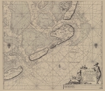
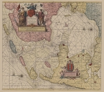
| Images |
|
|||||||||
| Relations |
|
|||||||||
| Map | ||||||||||
| Download |
Layer: MarineRegions:seavox_v19 - format: |
|||||||||
| Shapefile | [download] or view the complete The SeaVoX Salt and Fresh Water Body Gazetteer shapefile | |||||||||
| Edit history | Last edited on 2010-03-12 11:40:32 by De Hauwere Nathalie | |||||||||
| [Google] [Google scholar] [Google images] |


