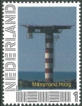
Marine Gazetteer Placedetails
| MRGID | http://marineregions.org/mrgid/24319 | ||||||
| Status | Proposed standard |
||||||
| Name |
|
||||||
| PlaceType | Light(house) | ||||||
| Latitude | 51° 58' 39.1" N (51.977529°) | ||||||
| Longitude | 4° 5' 48.4" E (4.096787°) | ||||||
| Source | The Lighthouse Directory, available online at http://www.unc.edu/~rowlett/lighthouse/ | ||||||
| Image | |||||||
| Relation |
|
||||||
| Map | |||||||
| Edit history | Last edited on 2011-09-06 08:38:56 by Decock Wim | ||||||
| [Google] [Google scholar] [Google images] |


