Maps
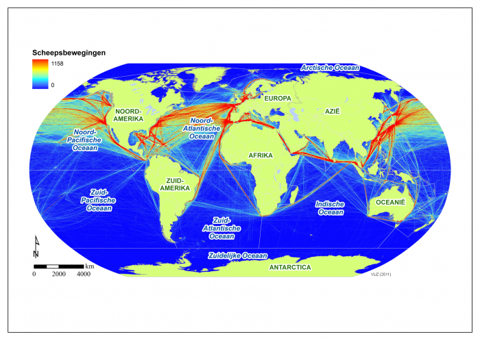
Shipping routes of cargo vessels larger than 10000 gigatonnes in 2007.
Description The color scale represents the number of trips on each route (data source: National Center for Ecological Analysis and synthesis (NCEAS)).
PNG file - 1.90 MB - 1 753 x 1 241 pixels
added on 2012-11-238 089 viewsGazetteer Places on this image:World Oceans
From reference Copejans, E.; Smits, M. (2011). De wetenschap van de zee:...
Download full size
This work is licensed under a Creative Commons Attribution-NonCommercial-ShareAlike 4.0 International License
Click here to return to the thumbnails overview


