Maps
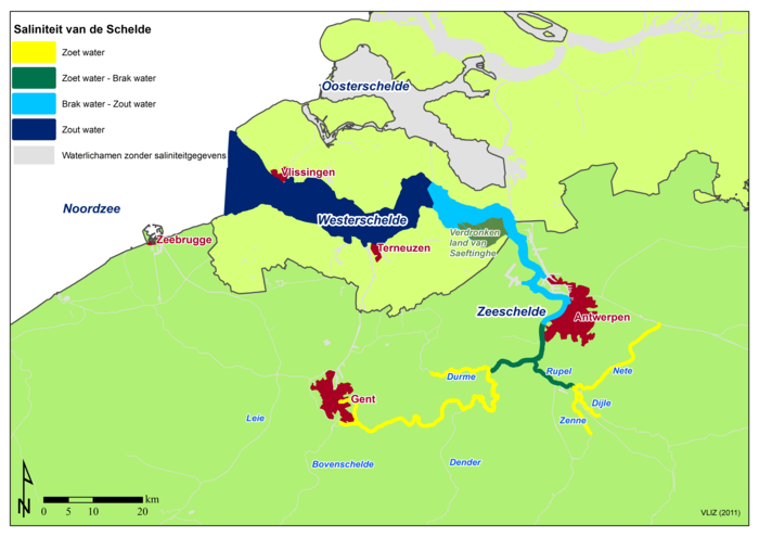
Salinity of the Scheldt
Description The tide in the Scheldt estuary penetrates far inland to Ghent, where the tidal sluices abruptly stop the tidal influence. Along the 160 km between the Scheldt estuary and Ghent, we find a very nice gradient of salt seawater, brakish water and fresh river water.(Source: Breine, J.J.; Maes, J.; Stevens, M.; Simoens, I.; Elliott, M.; Hemingway, K.; Van den Bergh, E. (2008). HARBASINS Report: Water management strategies for estuarine and transitional waters in the North Sea Region. Habitat needs to realise conservation goals for fish in estuaries: case study of the tidal Schelde. Rapport van het Instituut voor Natuur- en Bosonderzoek, R.2008.3. Instituut voor Natuur- en Bosonderzoek: Groenendaal. 45 pp.) Zeewetenschappen).
PNG file - 3.81 MB - 7 012 x 4 962 pixels
added on 2012-11-284 594 viewsGazetteer Places on this image:Schelde
From reference Copejans, E.; Smits, M. (2011). De wetenschap van de zee:...
Download full size
This work is licensed under a Creative Commons Attribution-NonCommercial-ShareAlike 4.0 International License
Click here to return to the thumbnails overview


